F O C U S
This studio invites students to work with current technology (the internet of things, point clouds, artificial intelligence, game engines, and digital twin) as tools that will help design and articulate proposals in a contemporary manner. The focus of the design studio will be on the concept: F L U I D. The projects will have to consider such a concept as a driving compass as students will encounter it throughout their work, rendered as a flood of data and water. They are asked to articulate an intervention that resembles fluidity in response to sea-level rice.
D E S C R I P T I O N
The brief for this design studio focuses on the intersection between water and land in Florida's landscape. This course is framed within the project GulfSouth. “GulfSouth is a platform for undergraduate and graduate design-based education that explores the critical challenges facing the Gulf of Mexico’s coastline and communities in the context of a changing climate”. We will explore the Gulf of Mexico from various scales, from the territorial to the human scale, to learn how to react to the influence of water, having a particular focus on sea-level rice. As they work on their design, students will also be exposed to Unreal Engine, AI Algorithms, and Point cloud models, which will be used to capture information from each particular scale.
D E S I G N B R I E F
This first project will rethink and design a data collection station to collect weather data and water quality. In this project, students will redraw an existing weather monitoring device and re-imaging its composition and purpose. Adding an extra instrument to collect a particular data type to align with their particular research interest for the second project, which will be about designing a mobile laboratory station that works in tandem with the data collection station. Students were asked to envision a part of their project (lab space) to be mobile, and consider what happened after the lab space is gone and how can the community still occupy their projects. The two exercises aim to discuss the vertical and horizontal composition and how to engage with the Florida landscape. Moreover, it opens a discussion on how to rethink the existence of data collection devices present in making smart cities. short description of the course
The Gulf
This module explored the act of mapping different scales, from territorial scale to site scale to human scale. Students engaged in exercises to collect data and produce maps that enforce the idea of authoring the data. In this module, the students learned how to work with GIS data and how to collect data from the site visit.

These images show all the work produce from concept development to the final first project, a data collection device.

These images show all the work produce from concept development to the final first project, a data collection device.

These images show all the work produce from concept development to the final first project, a data collection device.

These images show all the work produce from concept development to the final first project, a data collection device.

These images show all the work produce from concept development to the final first project, a data collection device.

These images show all the work produce from concept development to the final first project, a data collection device.

Student work
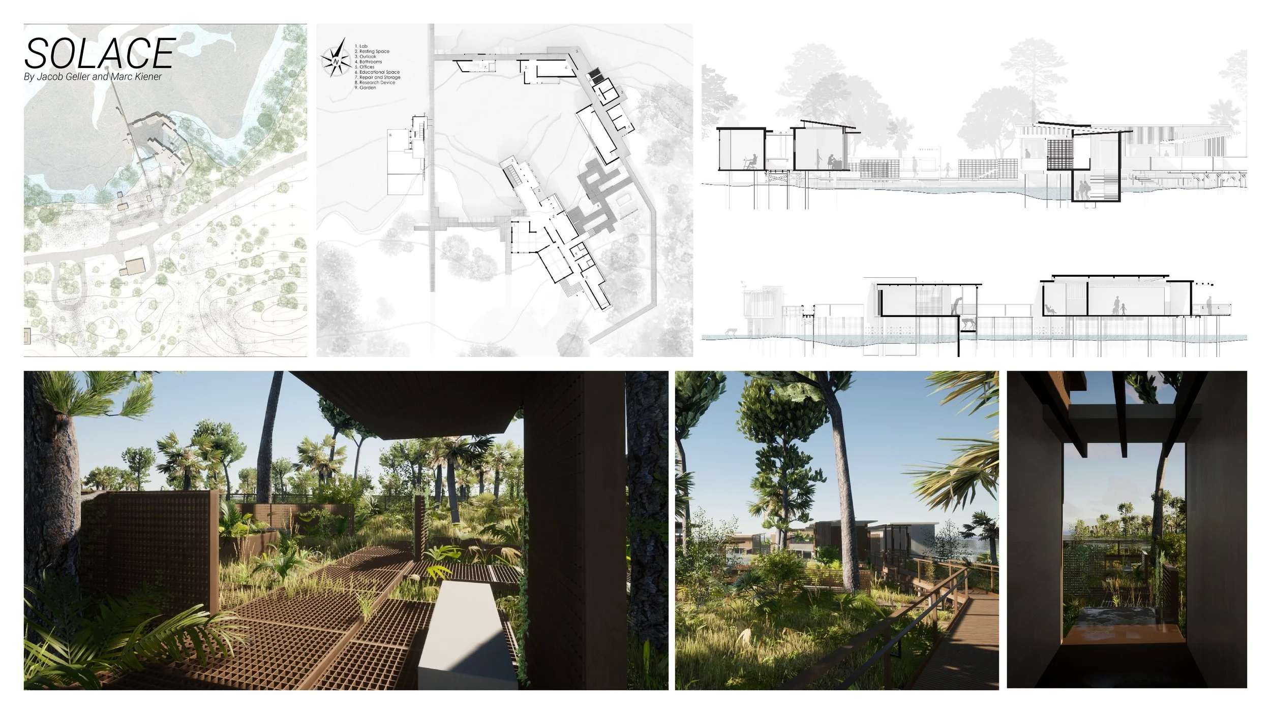
The second project, was designing a mobile laboratory station that works in tandem with the data collection station. Students envisioned a part of their project (lab space) to be mobile, and consider what happened after the lab space is gone and how can the community still occupy their projects. For representation we used Unreal Engine.
An Interactive platform
How to interact with the digital environment to inform physical design decisions? How to make some invisible features visible, creating a decision-making tool to aid design strategies? These questions are at the core of the projects. To address them, students used game engines as infrastructures to present the work. Playing allows participants to engage in your storytelling, as you will control the narrative of what each user will exercise when playing in your environment. Here is an example from Oliva and Daniel


